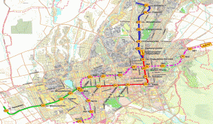
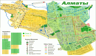
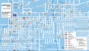
Almaty
 |
 |
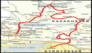
Almaty is still the major commercial, financial, and cultural centre of Kazakhstan, as well as its most populous and most cosmopolitan city. The city is located in the mountainous area of southern Kazakhstan near the border with Kyrgyzstan in the foothills of the Trans-Ili Alatau at an elevation of 700–900 m (2,300–3,000 feet), where the Large and Small Almatinka rivers run into the plain. The city, just like Astana and Shymkent, does not belong to any region and is officially a "city of state importance".
The city has been part of the UNESCO Creative Cities Network in the area of music since November 2017. The city was the host for a 1978 international conference on Primary Health Care where the Alma Ata Declaration was adopted, marking a paradigm shift in global public health.
From 1929 to 1936, the city, then known as Alma-Ata, was the capital of the Kazakh ASSR. From 1936 to 1991, Alma-Ata was the capital of the Kazakh SSR. After Kazakhstan became independent in 1991, the city was renamed Almaty in 1993 and continued as the capital until 1997, when the capital was moved to Akmola (renamed Astana in 1998, Nur-Sultan in 2019, and again Astana in 2022). Since then Almaty has been referred to as the 'southern capital' of Kazakhstan.
Almaty remains the largest, most developed, and most ethnically and culturally diverse city in Kazakhstan. Due to development by the Soviet Union and relocation of workers and industries from European areas of the Soviet Union during World War II, the city has a high proportion of ethnic Russians and Uyghurs. The city lies in the foothills of Trans-Ili Alatau (or Zailiysky Alatau) in the extreme south-east.
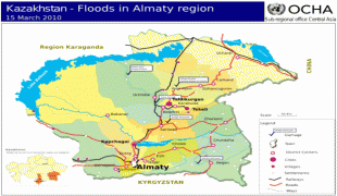
It has a relatively mild climate with warm and dry summers and quite cold winters. Since the city is in a tectonically active area, it has an endemic risk of earthquakes. Although most tremors do not cause any significant damage, Almaty has suffered some large destructive earthquakes.
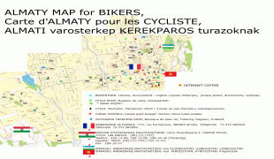
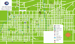
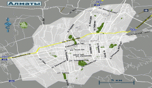
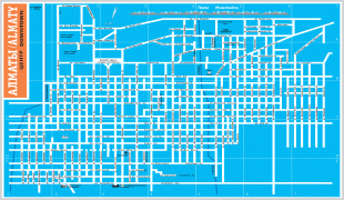
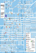
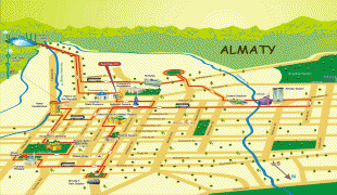
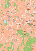
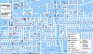
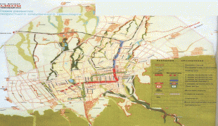
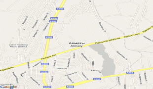
Map - Almaty
Map


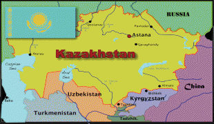
Country - Kazakhstan
 |
 |
| Flag of Kazakhstan | |
The country dominates Central Asia economically and politically, generating 60 percent of the region's GDP, primarily through its oil and gas industry; it also has vast mineral resources. Officially, it is a democratic, secular, unitary, constitutional republic with a diverse cultural heritage, and has the highest Human Development Index ranking in the region. Kazakhstan is a member state of the United Nations, World Trade Organization, Commonwealth of Independent States, Shanghai Cooperation Organisation, Eurasian Economic Union, Collective Security Treaty Organization, Organization for Security and Cooperation in Europe, Organization of Islamic Cooperation, Organization of Turkic States, and International Organization of Turkic Culture.
Currency / Language
| ISO | Currency | Symbol | Significant figures |
|---|---|---|---|
| KZT | Kazakhstani tenge | ₸ | 2 |
| ISO | Language |
|---|---|
| KK | Kazakh language |
| RU | Russian language |